
NationalAquatic Barrier Inventory
& Prioritization Tool
154,009 assessed barriers likely to impact aquatic organisms
9,402 removed for conservation
Fish and other aquatic organisms depend on high quality, connected river networks. A legacy of human use of river networks have left them fragmented by barriers such as dams and culverts. Fragmentation prevents species from dispersing and accessing habitats required for their persistence through changing conditions.
The National Aquatic Barrier Inventory & Prioritization Tool is part of the National Aquatic Connectivity Collaborative (NACC), which is a national effort to build a community of practice of resource management partners working together to identify aquatic barriers, prioritize these barriers for removal or mitigation, and implement barrier removal projects across political boundaries.
At the national scale, the National Aquatic Barrier Inventory and Prioritization Tool is made possible by funding from the U.S. Fish and Wildlife Service, American Rivers , the National Fish and Wildlife Foundation, U.S. Department of Agriculture, Forest Service, The Nature Conservancy, Trout Unlimited, and state wildlife grant funding from Florida and Texas. This effort would not be possible without the collaboration of our partners from numerous state, federal, and non profit organizations as well as the National Fish Habitat Partnership.


This inventory is a growing and living database of dams, culverts, and other road crossings that spans all 50 states, Puerto Rico, and the US Virgin Islands, compiled by Southeast Aquatic Resources Partnership (SARP) with the generous support from many partners and funders. It integrates existing datasets from local, state, and federal partners with data collected from ongoing field surveys and local knowledge of specific structures.
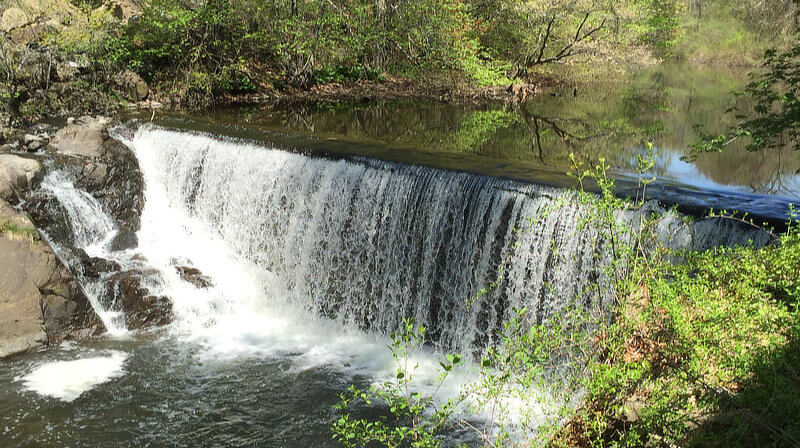 Flock Process Dam, Connecticut. Removed in 2018, restoring over 4 miles of stream access to diadromous species. U.S. Fish and Wildlife Service Northeast Region
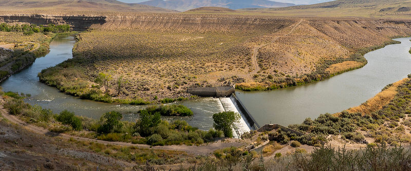 Numana Dam, Nevada. Fish passage structure project underway. N. Hurner, U.S. Fish and Wildlife Service
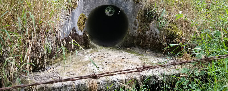 Culvert near Graham, WA replaced in 2025 for fish passage. Washington State Department of Transportation
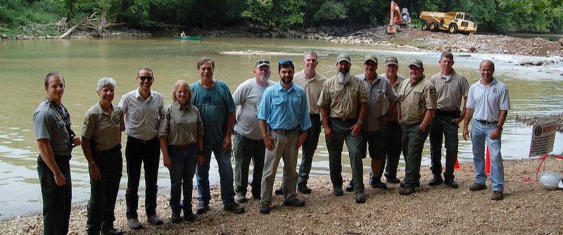 Roaring River Dam Removal, Tennessee, 2017. Mark Thurman, Tennessee Wildlife Resources Agency.
In order to fill data gaps, partners have been inventorying barriers in the field from the bottom up, using a standardized protocol developed by the North Atlantic Aquatic Connectivity Collaborative (NAACC). The North Atlantic Aquatic Connectivity Collaborative (NAACC) is a network of individuals from universities, conservation organizations, and state and federal natural resource and transportation departments focused on improving aquatic connectivity across a thirteen-state region, from Maine to West Virginia. As this protocol has expanded across the country, partners from fifteen states within the southeastern region, as well as additional states in the Great Plains and Intermountain West have adopted this protocol, which will now be coordinated and managed at the National scale by the National Fish Habitat Partnership, now called the National Aquatic Connectivity Collaborative.
National Aquatic Connectivity Collaborative
Enhancing aquatic connectivity by empowering people with actionable data

Inventory
Learn more about the inventory.

Prioritization
Read more about the methods here...

Teams
Learn more about Aquatic Connectivity Teams.
Learn more about the National Aquatic Connectivity Collabrative and explore Frequently Asked Questions about it.
Get started using this tool
This inventory and prioritization tool is designed to guide users in identifying high priority barrier removal projects. To access information about to funding sources for barrier removal, please visit the Fish Passage Portal. The portal is a "one-stop shop" for anyone who needs information, funding, or resources to improve fish passage and aquatic connectivity projects. It provides landowners and public lands managers the tools to find funding across the federal government, as well as access to data, planning, and geospatial information.
Summarize the inventory
Explore summaries of the inventory by state, county, or different levels of watersheds.
These summaries are a good way to become familiar with the level of aquatic fragmentation for many states across the U.S. Find out how many aquatic barriers have already been inventoried in your area! Just remember, the inventory is a living database, and is not yet comprehensive across these states.


Prioritize aquatic barriers for removal
Identify barriers for further investigation based on the criteria that matter to you.
You can select specific geographic areas for prioritization, including counties, states, and watersheds. You can filter the available barriers based on criteria such as likely feasibility for removal, height, and more. Once you have prioritized aquatic barriers, you can download a CSV file for further analysis.


Map services
If you would like to access map services of a recent version of the aquatic barriers and connectivity results (may not match the exact version here), you can import one of the following connectivity analysis map services into your GIS tool of choice:
- Dams based on networks that are cut by dams and waterfalls.
- Assessed road crossings based on networks that are cut by dams, waterfalls, and assessed crossings.
- Dams and assessed road crossings based on networks that are cut by dams, waterfalls, and assessed crossings.
Explore the inventory by region:


Get involved!
You can help improve the inventory by sharing data, assisting with field reconnaissance to evaluate the impact of aquatic barriers, joining an Aquatic Connectivity Team, or even by reporting issues with the inventory data in this tool.
Contact us to learn more about how you can help improve this barrier inventory and tool.
If you are not able to get what you need from this tool or if you need to report an issue, please let us know!